Marshall Fire - Louisville & Boulder County along Davidson Mesa

Boulder County, Colorado, December 30, 2021
Go to Marshall Fire (Part 2) - Creek (Go to About Navigation)
View NW to the Marshall Fire as it approaches Superior, from Hwy 128 south of the Rock Creek neighborhood. Photo: Kristen Felton via 9News Denver
Marshall Fire crossing US 36 (Boulder Turnpike) onto Davidson Mesa Open Space in Louisville. The fire followed the open space into several neighborhoods on and along the mesa, including the two straddling McCaslin Blvd. Video: Garrett Steed via 9News Denver
Avista Adventist Hospital staff look NNW across remains of Coal Creek Ranch South to Davidson Mesa, where neighborhoods on both sides of McCaslin Blvd are burning. Photo: Wendy Cardona via 9News Denver
Presiden Biden with Louisville fire chief John Wilson, getting a tour of Marshall Fire damage in Louisville. Photo: 9News Denver
View north above McCaslin Blvd where it climbs Davidson Mesa in Louisville. Large neighborhoods on both sides were destroyed by the Marshall Fire. Photo: 9News Denver
Looking east into one small part of the neighborhoods on Davidson Mesa east of McCaslin Blvd. 985 Arapahoe Cir (C) is the lone survivor in this photo, at the corner of Willow Pl (bottom) and Arapahoe Cir (on the right). Honeysuckle Ln is on the left. This area is immediately east of McCaslin and a little south of Harper Lake. Photo: 9News Denver
View ESE to the rear of 836 (center) & 829 (far R) Mt Evans Ct (probably - there isn't enough detail to be certain of the location). If so, the view is from the area immediately south of Harper Lake. Video: 9News Denver
View ESE to the rear of 836 Mt Evans Ct (probably - there isn't enough detail to be certain of the location). If so, the view is from the area immediately south of Harper Lake. Video: 9News Denver
Homes burning in the Marshall Fire. There isn't enough detail in this 9News photo to determine the location, but this may be the rear of 829 (R) & 836 (L) Mt Evans Ct, viewed from the backyard of 814 Flatirons Ct looking east. Video: 9News Denver
View SSW from Washington Ave into the Arapahoe Cir and Eldorado Ln neighborhoods. Only one home (905 Sunflower St, just beyond L) survived in this large area between Washington on the north and Via Appia on the south (in the far distance).
View SW from Washington Ave into the Willow Pl & Honeysuckle Ln neighborhood. Only 1017 and 985 Arapahoe Cir survived in this area between Washington and McCaslin Blvd.
View SE to 822 Trail Ridge Dr before the Marshall Fire. Photo: Google Maps
View SE to 824 Trail Ridge Dr before the Marshall Fire. Photo: Google Maps
View SSE to 826 Trail Ridge Dr before the Marshall Fire. Photo: Google Maps
View ENE to the remains of 824 (R) and 822 (L) Trail Ridge Dr. Surviving homes along the east-west section of lower Trail Ridge Dr are visible in the background.
View SE to what is left of 830 (R), 828 (C), and 826 (L) Trail Ridge Dr after the sites were cleared following the Marshall Fire. The SW corner of the Louisville Rec Center is just visible at center.
View NE to 844 Trail Ridge Dr before the Marshall Fire. Photo: Google Maps
View NE to the remains of 844 Trail Ridge Dr.
View WSW from SW off Pine St over the remains of two Owl Dr townhouse buildings (R & far L), to one of the surviving buildings. Only ten of the complex's fifteen buildings survived; three were completely destroyed and two were severely damaged. (Each building contains six townhouses.) This is on the south side of Via Appia, a little ESE of and below the homes lost on Trail Ridge Dr.
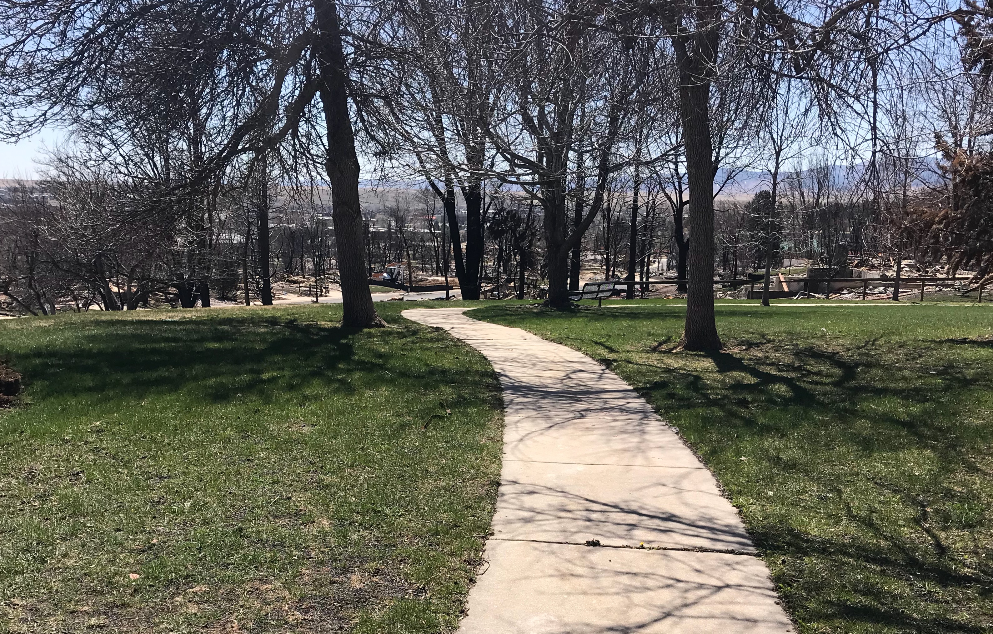
View SW along the edge of Davidson Mesa to the Panorama Dr area (top, left half). The Panorama Dr area and the Spanish Hills/Paragon Estates area (upper R & beyond R) are outside of Louisville's city limits in unincorporated Boulder County. The damage in Spanish Hills/Paragon was extensive, but spotty. However, the Panorama Dr area is mostly gone, except for a few houses here and there.
View ENE to 7592 Panorama Dr before the Marshall Fire. This neighborhood is on top of Davidson Mesa just west of Louisville's city limits. This unusual, strikingly modern home, at the NE end of Panorama Dr, was designed by an architect who also owned it and lived in it. Photo: Google Maps
View ENE to the remains of 7592 Panorama Dr on Davidson Mesa, an unusual, strikingly modern home at the NE end of Panorama. It was designed by the architect who owned it and occupied it.
View SE to the rear of 7387 Panorama Dr from its backyard, before the Marshall Fire. This home would have had a spectacular view over Boulder and the Boulder Valley, to the Front Range and the Continental Divide. It was a very recently completed new home replacing the original home on this property. Photo via 9News Denver
 
View SE to the rear of 7387 Panorama Dr, burning. This photo may have been taken from the backyard of 7348 Spring Dr. When it was taken, this area should have already been fully evacuated. Photo: 9News Denver
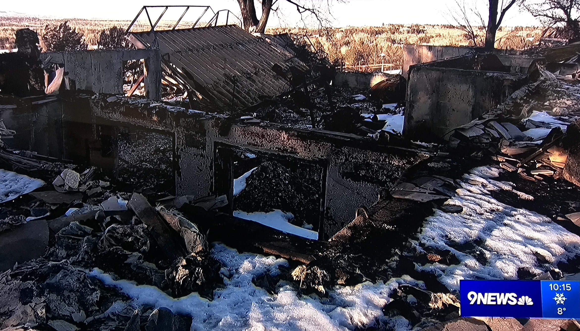
Side view in front of 7387 Panorama Dr after the Marshall Fire. Steel framework of the rear balcony has fallen into the building after the wall it was attached to burned. Photo: 9News Denver
View ESE to 7496 Panorama Dr before the Marshall Fire. Photo: Google Maps
View ESE to the remains of 7496 Panorama Dr.
Young couple lost their recently completed new home on Panorama Dr to the Marshall Fire. Photo: 9News Denver