Marshall Fire - Superior & Louisville along Coal Creek
Boulder County, Colorado, December 30, 2021
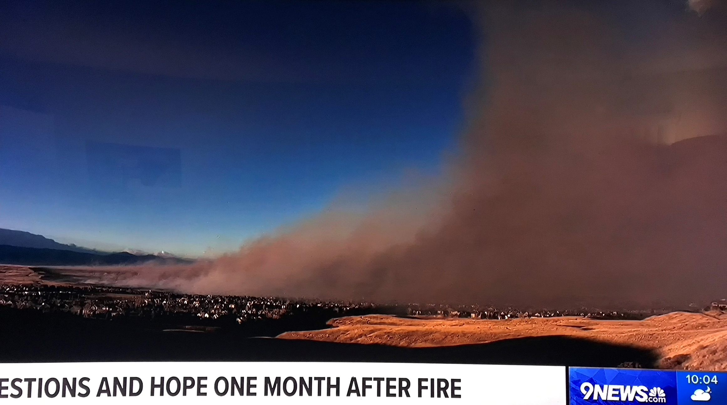
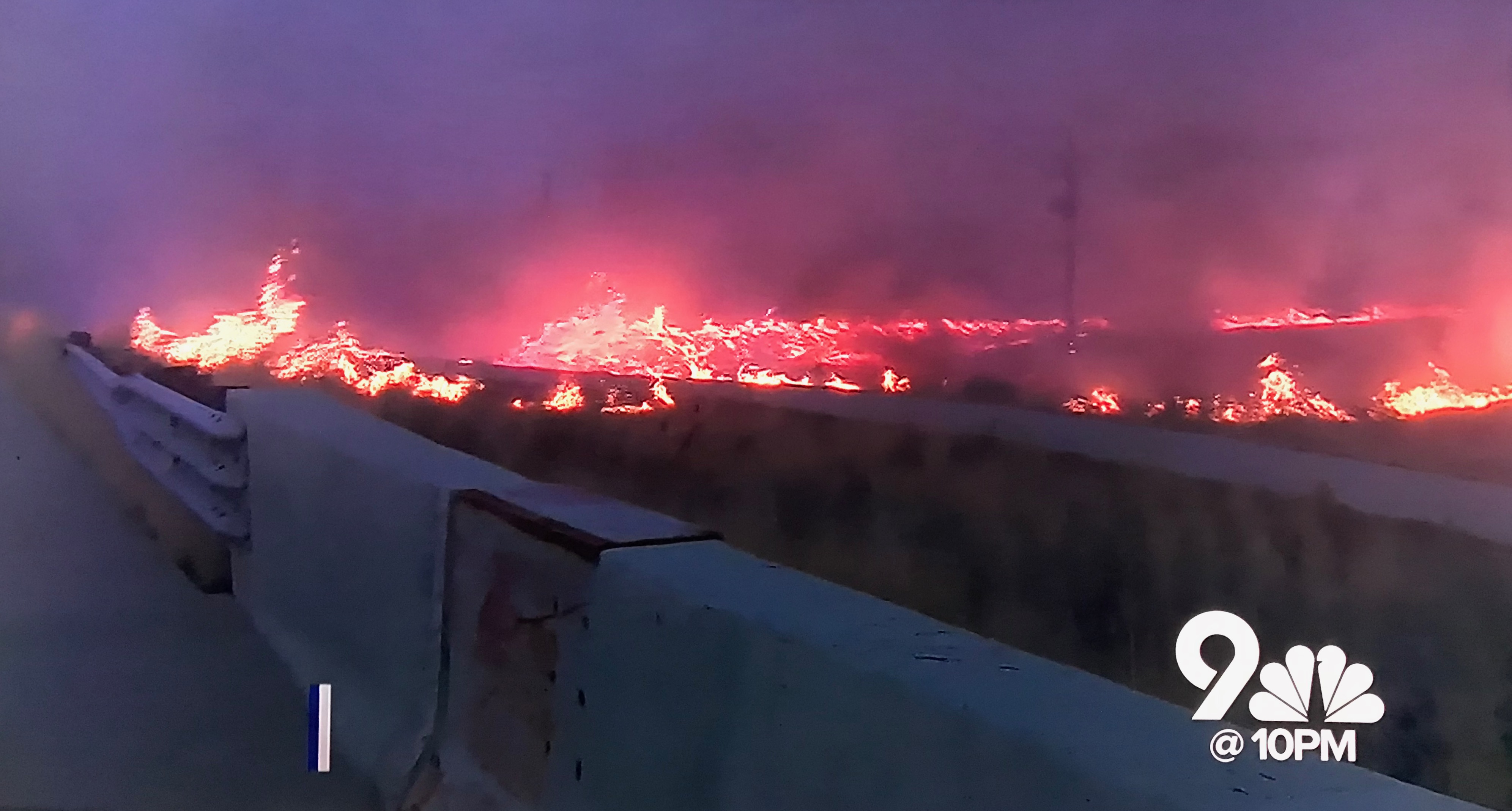
View NW to the Marshall Fire as it approaches Superior, from Hwy 128 south of the Rock Creek neighborhood. Photo: Kristen Felton via 9News Denver
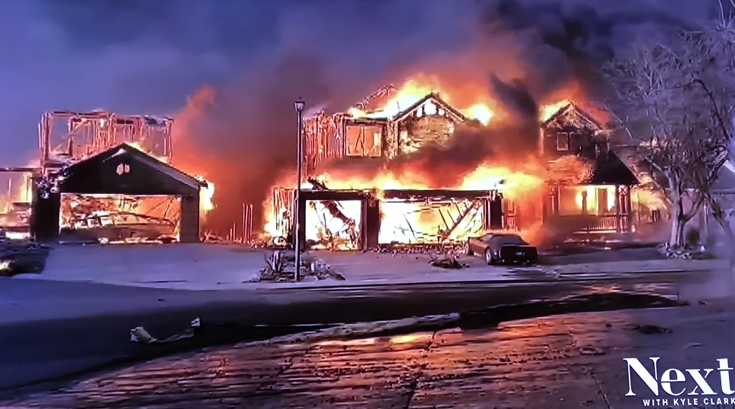
The Marshall Fire devouring Old Town Superior. Video: 9News Denver
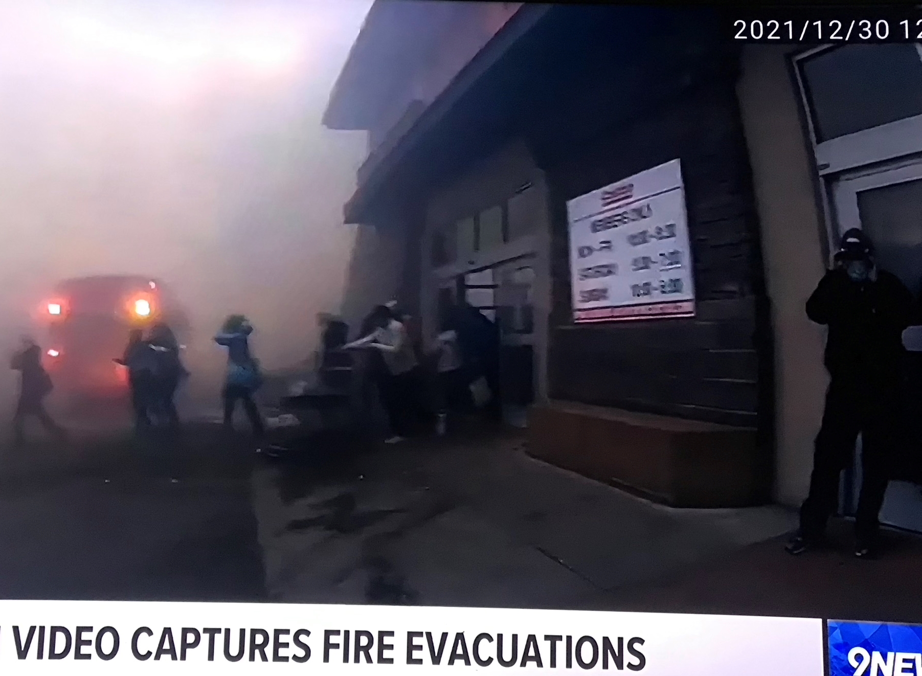
Shoppers being evacuated from Costco in the Superior Marketplace. Video via 9News Denver
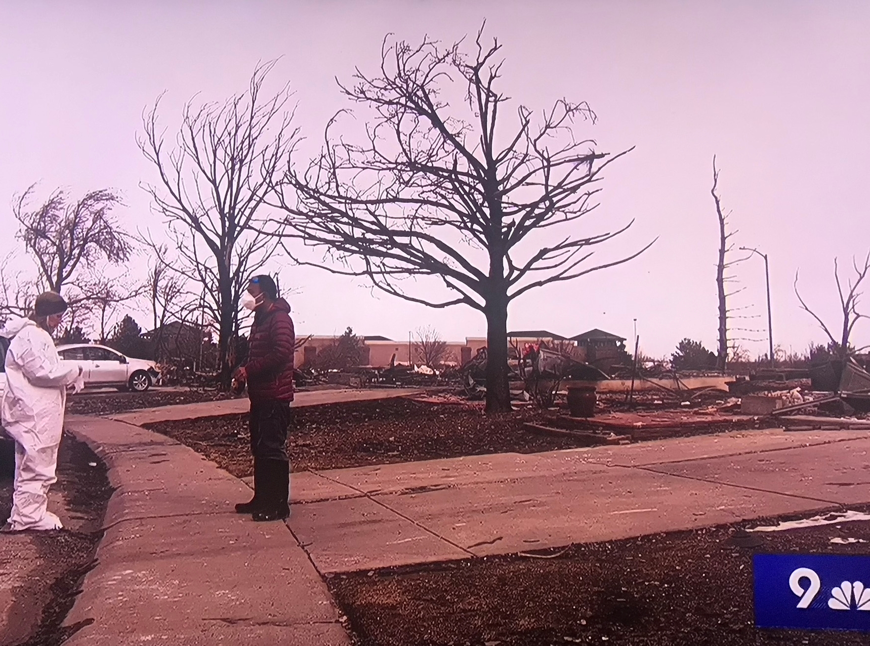
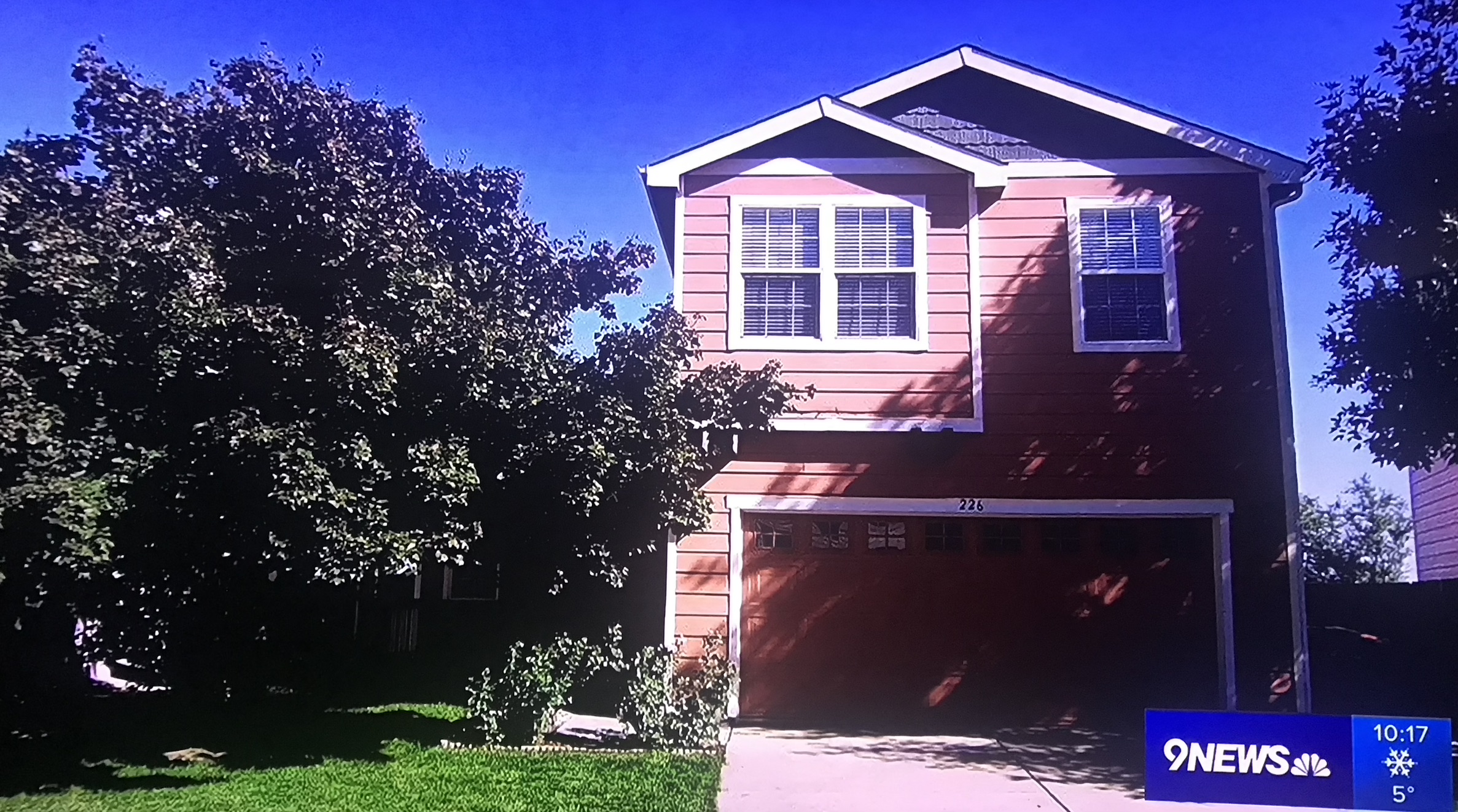
Driveway of 226 Mohawk Cir, Sagamore, Superior, looking NNE. Superior Marketplace is visible in the distance. Photo: 9News Denver
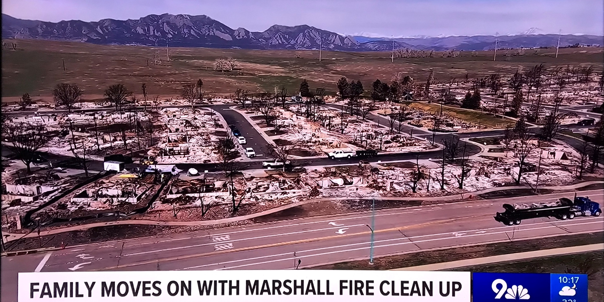
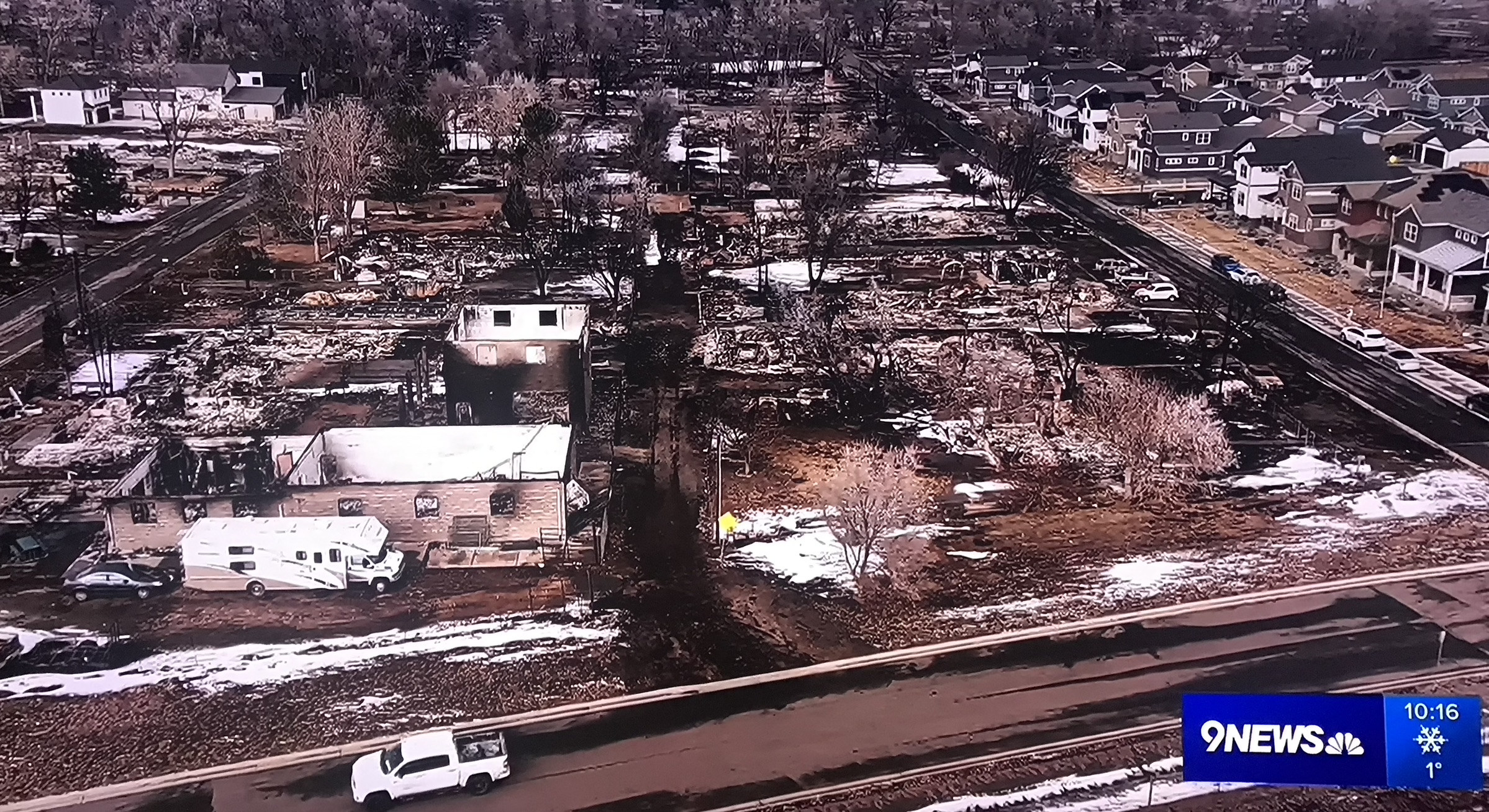
View WNW over 76th St and the remains of the Sagamore neighborhood in Superior after the Marshall Fire. Video: 9News Denver
226 Mohawk Cir, Sagamore, Superior, before Marshall Fire. Photo: 9News Denver
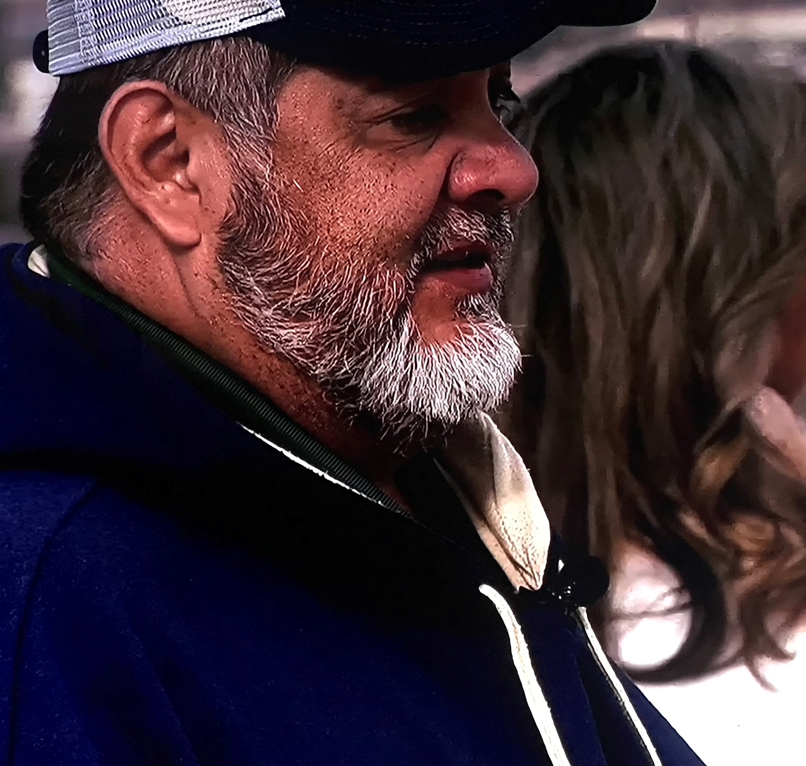
Nepalese immigrant family who lost their home in the Sagamore neighborhood of Superior. Photo: 9News Denver
Children of Nepalese immigrants who lost their home in the Sagamore neighborhood of Superior. Photo: 9News Denver
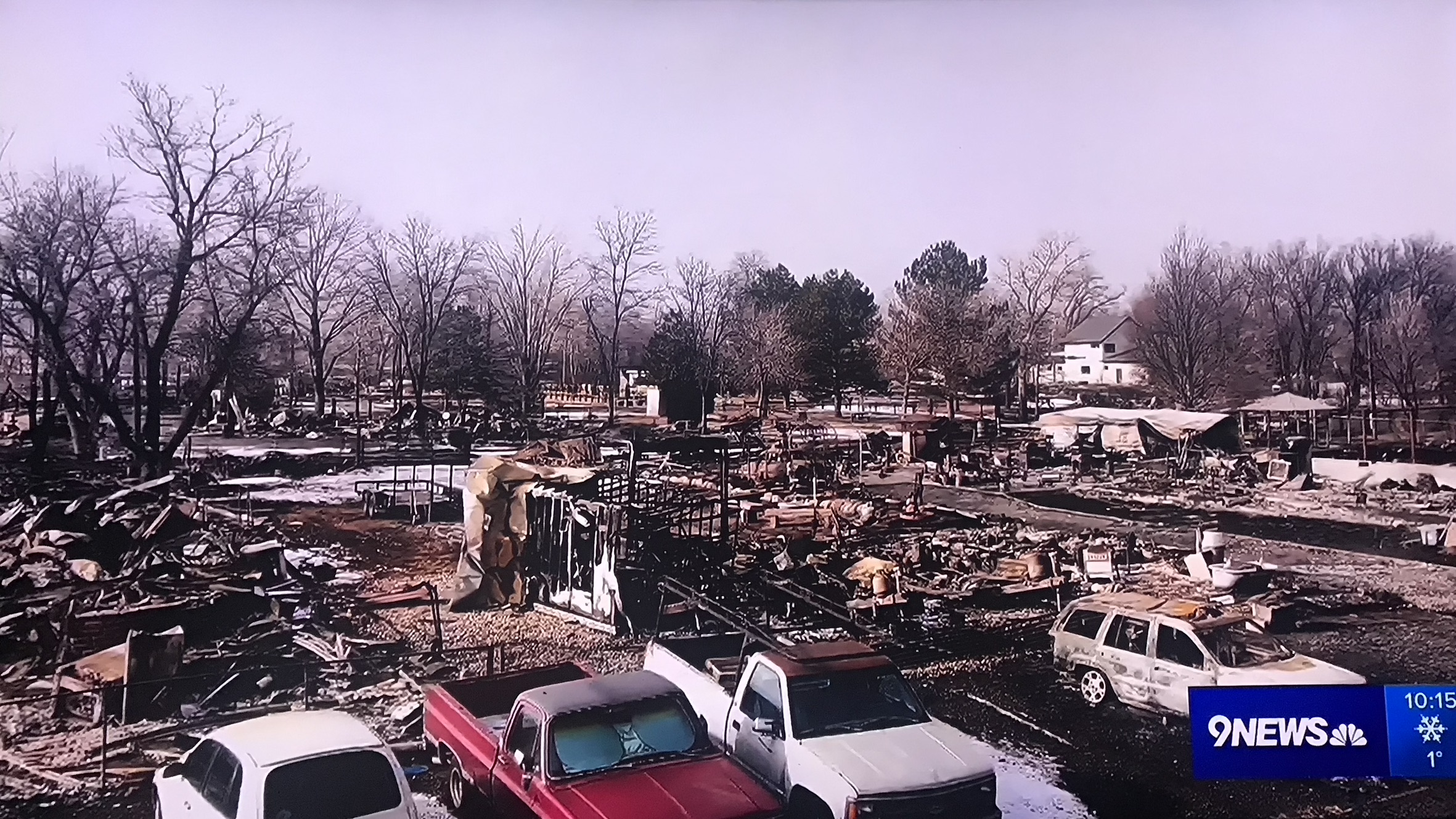
The 'Chavez compound' was in this area of Original Superior south of Coal Creek. Four generations of the Chavez family lived here in five houses. The Marshall Fire destroyed all of them. Photo: 9News Denver
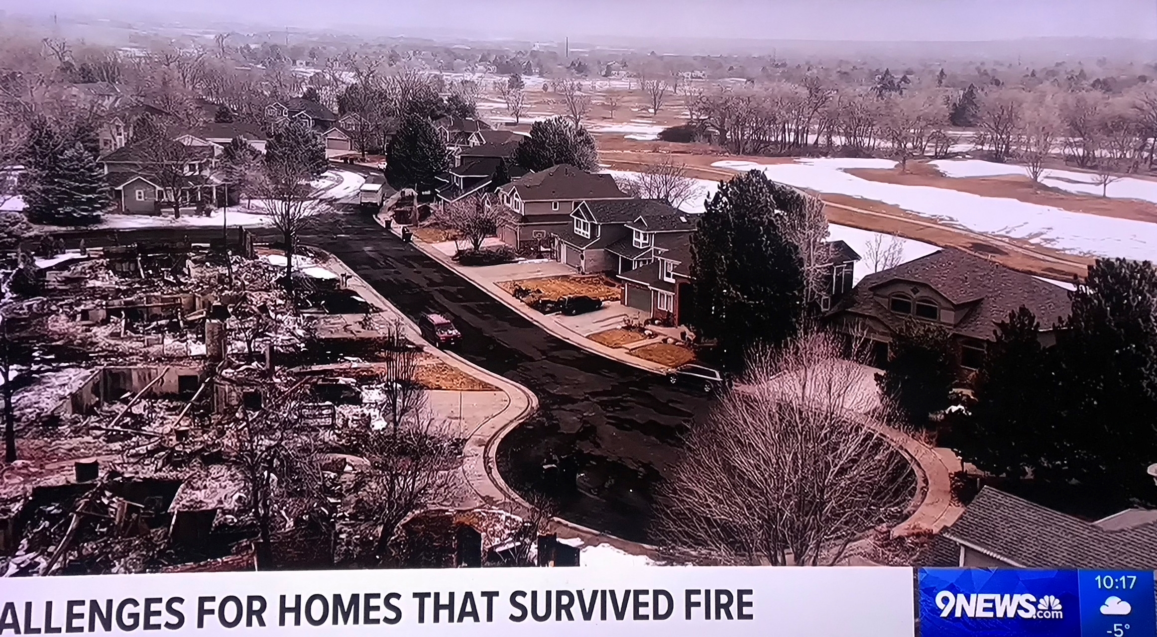
View north over Original Superior south of Coal Creek. The new neighborhood directly east (far right) appears to have survived. Photo: 9News Denver
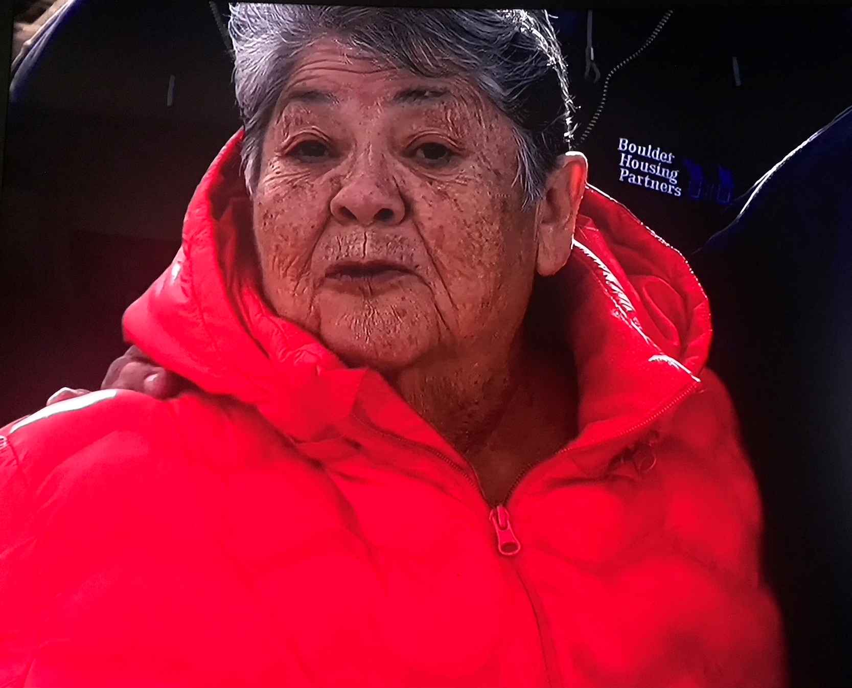
'Mom,' Chavez family matriarch. Photo: 9News Denver
One of the Chavez family's second generation. Photo: 9News Denver
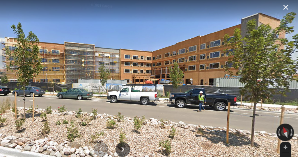
Element Boulder Superior by Westin Hotel under construction in July 2018. Photo: Google Maps
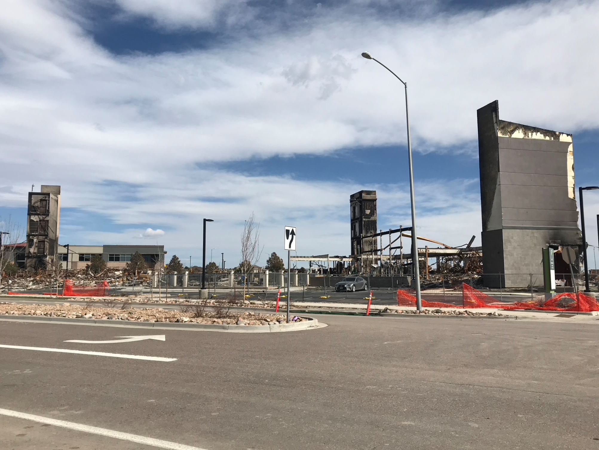
Remains of the Element Boulder Superior by Westin Hotel after the Marshall Fire.
The fire followed Coal Creek (right) from Superior into Louisville, where the Coal Creek Golf Course (far right) parallels the creek. The fire jumped the golf course and destroyed the Coal Creek Ranch South neighborhood south of Dillon Rd and part of the Coal Creek Ranch North neighborhood north of Dillon.
View ESE across Coal Creek and Coal Creek Golf Course from Coal Creek Trail area just SW of Dillon Rd. The remains of the destroyed Coal Creek Ranch South neighborhood is visible in the background on the right.
Avista Adventist Hospital staff look NNW across remains of Coal Creek Ranch South to Davidson Mesa, where neighborhoods on both sides of McCaslin Blvd are burning. Photo: Wendy Cardona via 9News Denver
Presiden Biden with Louisville fire chief John Wilson, getting a tour of Marshall Fire damage in Louisville. Photo: 9News Denver
View north to 359 & 361 Troon Ct in the Coal Creek Ranch South neighborhood south of Dillon Rd in Louisville. These houses were just northeast of Avista Adventist Hospital across a large open field (behind the camera). Video: 9News Denver
View NNE from north end of the 88th St overpass across US 36 (Boulder Turnpike). Louisville's Monarch High School is just beyond the fire (center). Avista Adventist Hospital is a little NW of here. 88th St dead-ends at Dillon Rd ahead (L). Video: 9News Denver
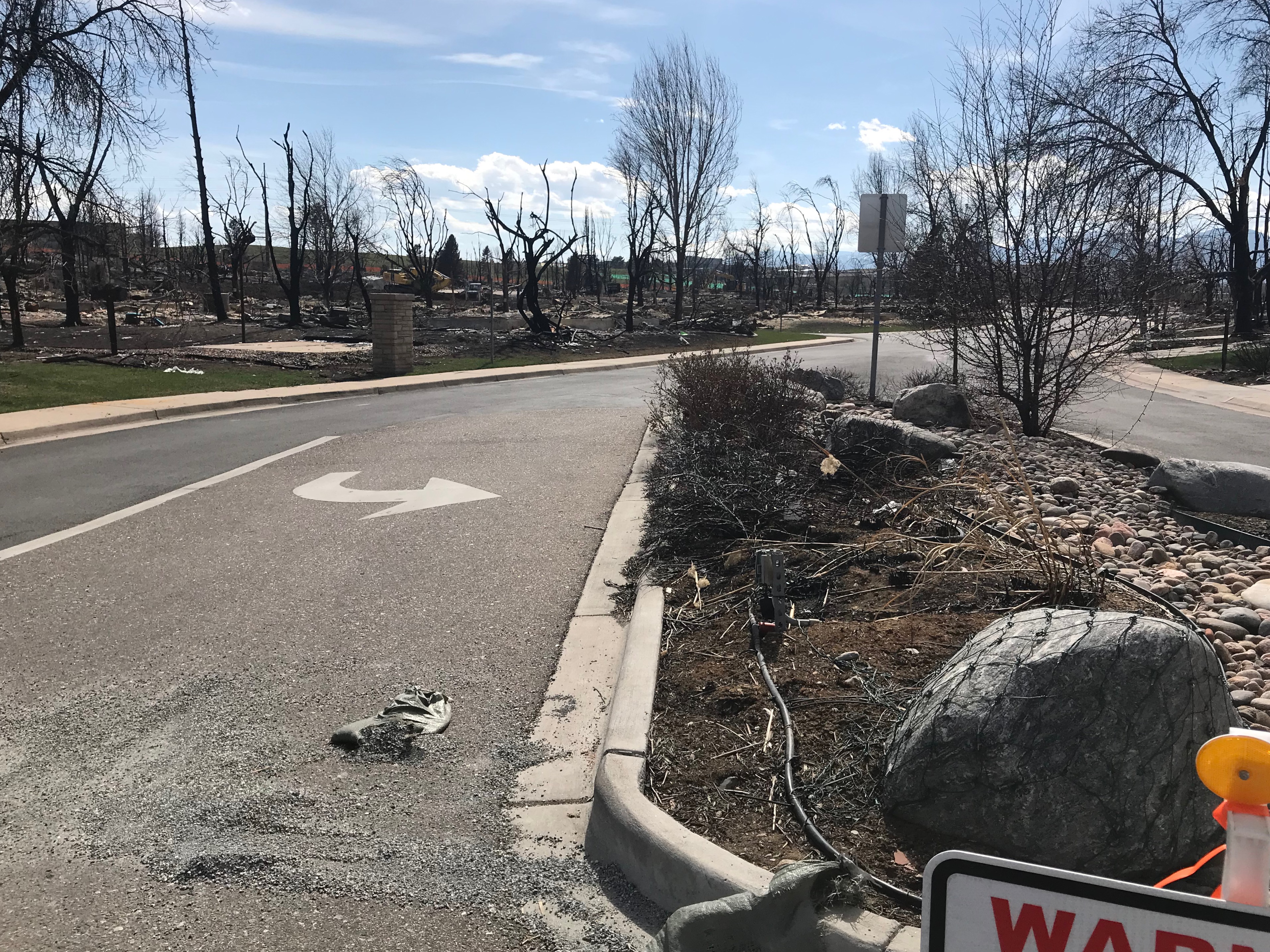
View SW into Coal Creek Ranch South neighborhood at the Dillon Rd entrance. All but three or four houses were destroyed. Coal Creek Golf Course is just beyond right.
View south from Dillon Rd into the east end of Coal Creek Ranch South neighborhood.
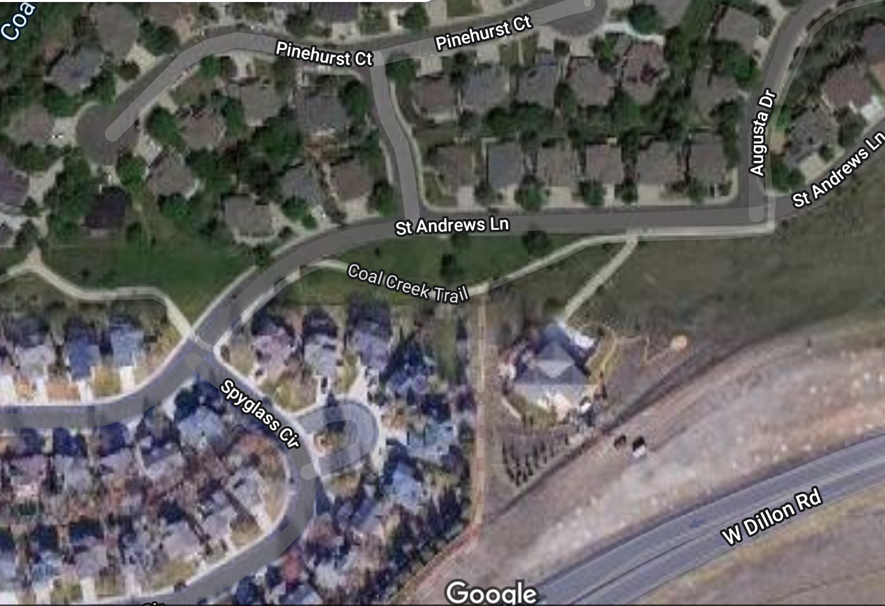
Satellite view of central Coal Creek Ranch North. The fire moved east before crossing Dillon Rd, missing the SW part of the neighborhood (lower left). It destroyed the large home right of center (750 St Andrews Ln) and the homes immediately west of it (802-816 Spyglasss). It moved north and took the block between St Andrews Ln and Pinehurst Ct. The row north of Pinehurst along the golf course survived, as did homes along Augusta Dr and NE St Andrews Ln (upper right). Photo: Google Maps
View S over St Andrews Ln to the remains of eight homes (802-816 Spyglass) along NE end of Spyglass Ct.
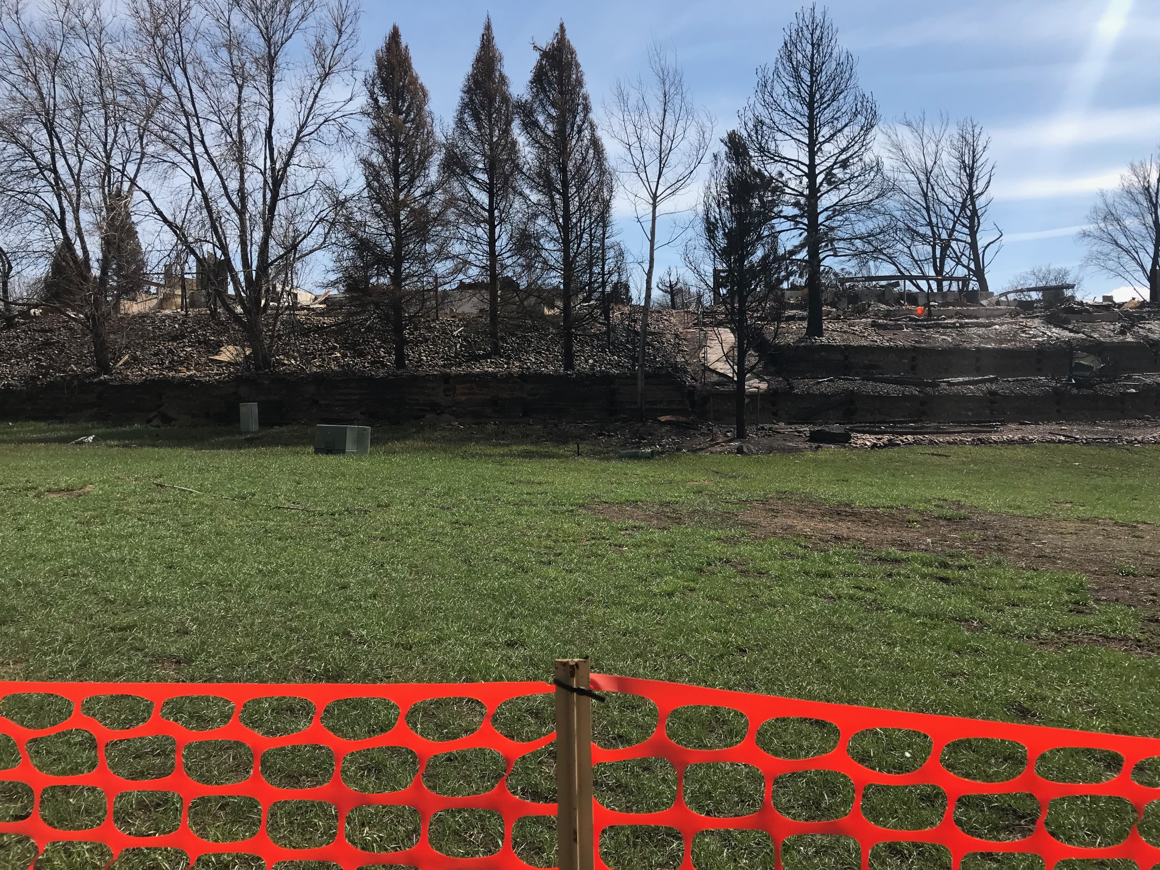
Looking SE from the south side of St Andrews Ln. The remains of 804, 806, and 808 Spyglass Cir are on the right. The remains of the large house at 750 St Andrews Ln are on the left, beyond the trees.
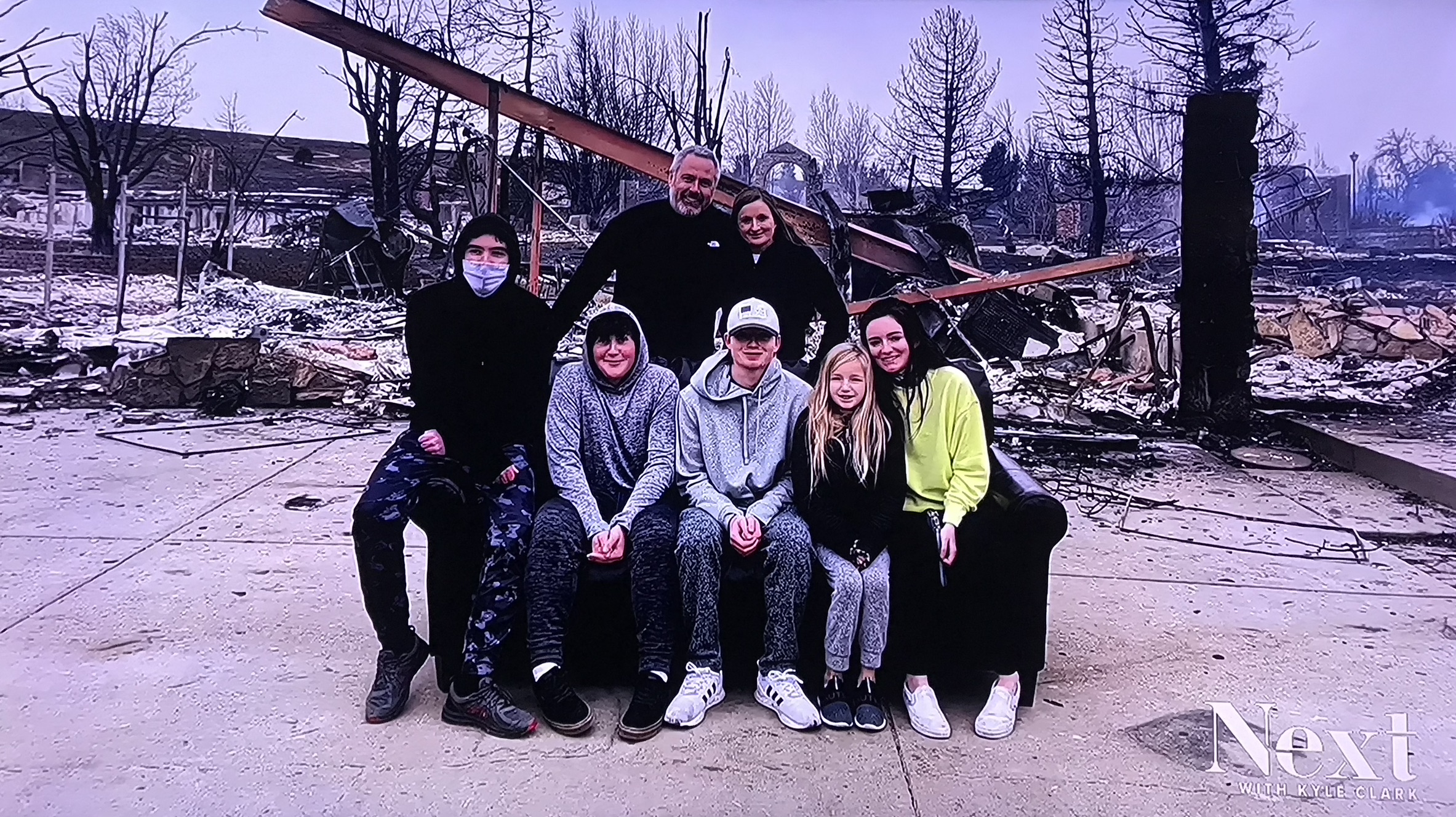
Family sitting in front of their home on the only thing that survived -- an old sofa on route to the thrift store during the fire (the store rejected the sofa). This looks like 760 Pinehurst Ct just south of Coal Creek Golf Course, in the Coal Creek Ranch North neighborhood north of Dillon Rd. The entryway arch from 761 St Andrews Ln is visible in the background.
View north to 771 and 761 St Andrews Ln in the Coal Creek Randh North neighborhood north of Dillon Rd. The brick arch (R) was the entryway to 761. The surviving houses in the background are on the north side of Pinehurst Ct and back up onto the golf course.
View west above Pinehurst Ct in the Coal Creek Ranch North neighborhood north of Dillon Rd. Homes close to the golf course here survived, but many farther away did not.
Coal Creek Ranch North neighborhood north of Dillon Rd, looking west from Augusta Dr. St Andrews Ln is on the left, Pinehurst Ct is on the right, Coal Creek Golf Course is beyond right.
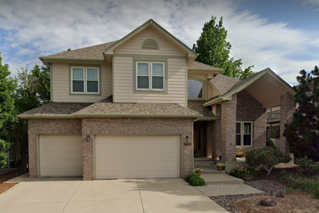
Example of homes in Coal Creek Ranch North. This is 731 St Andrews Ln before the Marshall Fire. Photo: Google Maps
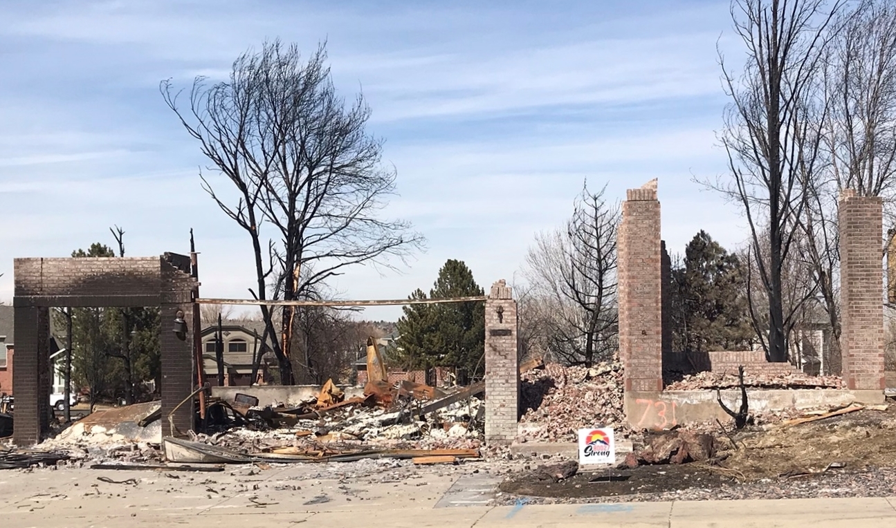
View N to the remains of 731 St Andrews Ln.
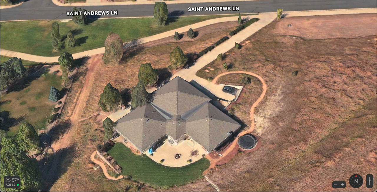
Another example of homes in Coal Creek Ranch North. This is 750 St Andrews Ln before the Marshall Fire. Photo: Apple Maps
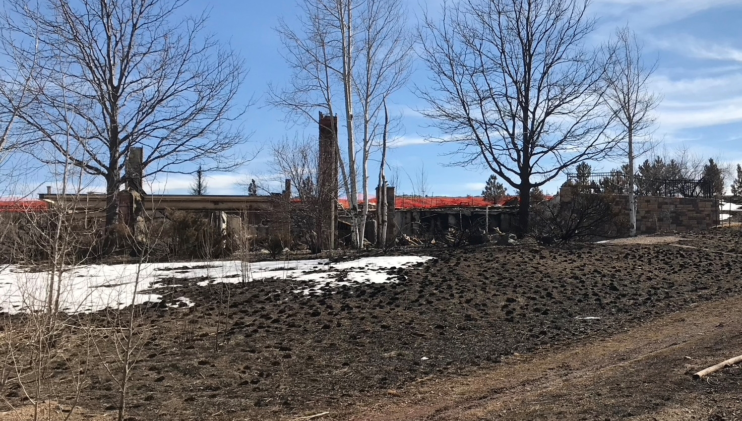
View SE to the remains of 750 St Andrews Ln from the Coal Creek Trail (concrete sidewalk in the aerial photo above), just S of St Andrews Ln where a small dirt path heads S from the trail. The home is turned 45 degrees; this was its NW side.